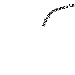
0 R LIBERTY POLE ROAD
Owner Information
TOWN OF HINGHAM CONS COMM
210 CENTRAL STREET
HINGHAM, MA 02043


Property Details
0 R LIBERTY POLE ROAD is classified as a Conservation (Vacant land).
The primary structure on this property was built in 1500.
0 R LIBERTY POLE ROAD is valued at $9,600. The land is valued at $9,600 and the structures are valued at $0.
This property is in Zone XX. Confirm with local Zoning Board authorities to ensure there are no overlays or other easements on this property.
The most recent deed for 0 R LIBERTY POLE ROAD is recorded at the local registrar in Book 2910, Page 0354. 0 R LIBERTY POLE ROAD was last sold on Monday, January 15, 1962 for $1.
Assessment data from fiscal year 2022.
Flood Data
According to the FEMA National Flood Hazard Layer, this property does not appear to be in a flood zone. It may also be in an area not yet reviewed. Nonetheless, confirm this information prior to taking any action.
To view the flood hazards around this property, create a FEMA "Firmette" Map of the area around 0 R LIBERTY POLE ROAD.
Broadband Internet Providers
| Provider | Type | Bandwidth (mbps) | |
|---|---|---|---|
| VSAT Systems, LLC. | Satellite | 2 | 1 |
| HughesNet | Satellite | 25 | 3 |
| GCI Communication Corp. | Satellite | 0 | 0 |
| Comcast | Cable | 1000 | 35 |
| Verizon New England Inc. | Fiber | 940 | 880 |
| Verizon New England Inc. | DSL | 1 | 0 |
| Viasat Inc | Satellite | 100 | 3 |
Broadband service provider data from December 2020.
Adjacent Properties
- 27 LIBERTY POLE ROAD
Single Family Residential owned by VAN DER KIEFT CHRISTOPHER & CHRISTINE - 25 LIBERTY POLE ROAD
Single Family Residential owned by BALTERA VICTOR N & - 29 LIBERTY POLE ROAD
Single Family Residential owned by SIMPSON DONALD B & JENNIFER A - 31 LIBERTY POLE ROAD
Single Family Residential owned by ROMAN STEVEN D - 23 LIBERTY POLE ROAD
Single Family Residential owned by ONEILL JAMES A & SARA W - 831 MAIN STREET
Pub-School owned by TOWN OF HINGHAM